-
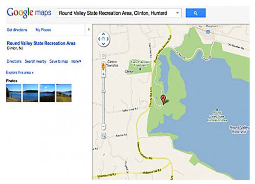
Detour Needed
For the last three years, a technical glitch in Google Maps has led tourists looking for the entrance to Round Valley State Park in New Jersey to the driveway of resident Laurie Gneiding. Gneiding tells ABC News that the number of tourists visiting their house grew from a handful to far too many this summer. Gneiding, who purchased an 8-foot-long traffic barricade and signs, says even that hasn’t stopped tourists from pulling into her driveway. During the July 4th holiday this year, she made a sign on a sheet of plywood saying, “NOT Park Entrance…Private Driveway… Google Maps is Wrong!”
-
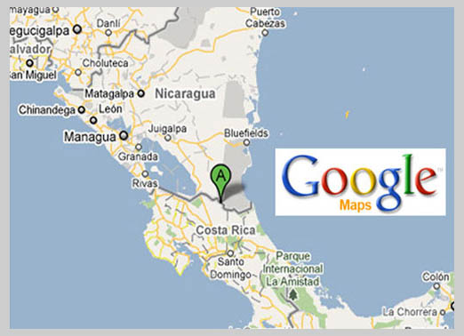
Costa Rica Accidentally Invades Nicaragua
In November 2010, Nicaraguan troops unknowingly crossed the border to Costa Rica, removed that country’s flag and replaced it with their own. The reason: Google Maps told the troops’ commander the territory belonged to Nicaragua. As a result, the Organization of American States and the U.N. Security Council were called in to mediate the border dispute, determining, in fact, that Google Maps was wrong.
-
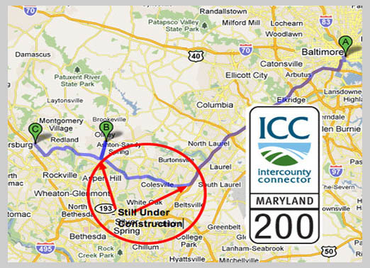
Still Closed for Business
The Intercounty Connector, Maryland’s first all-electronic toll road, is scheduled to open in full by Spring 2012. In March, the state opened a six- mile stretch, but a Google Maps error reported that all 18.8 miles were open for business. Unknowing passersby relying on Google Maps were none-too-thrilled with their unexpected detour.
-
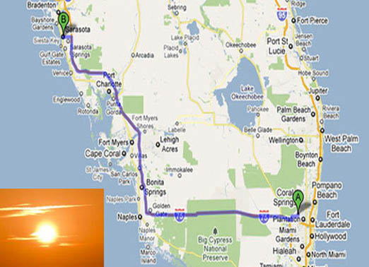
Sunsetting a City
For a month last summer, Sunrise, Fla., was a victim of Google Maps’ black hole. It no longer existed. Instead, people who searched Google Maps for the city were redirected to Sarasota, Fla.-similar in alphabetical listing, though some 200 miles apart. Also gone were Sunrise’s businesses, addresses and phone numbers from Web searches. Even its city hall and other public spaces were absent. Google later fixed the “technical error,” putting Sunrise back on the map.
-
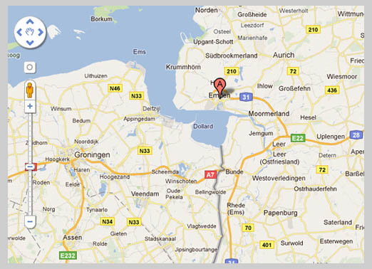
Reigniting a European Border War
Google Maps brought a border dispute from the 15th century back into the news in February when it placed most of the harbor in Emden, Germany, under Dutch sovereignty. According to the Dutch, the harbor lies between the northern Netherlands and Germany, but Germans claim the entire estuary as their territory.
-
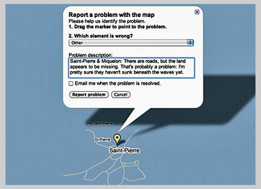
Taking On Water
What happened to two French islands off the coast of Newfoundland in May 2010? According to Google Maps, they went the way of Atlantis-entirely submerged by water. The person who reported this error to Google clearly had fun with it, writing, “Saint-Pierre & Miquelon: There are roads, but the land appears to be missing. That’s probably a problem: I’m pretty sure they haven’t sunk beneath the waves yet.”
❮ ❯